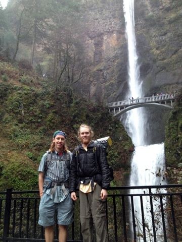
 Over Thanksgiving weekend and my buddy George and I attempted to thru hike the Mark O’ Hatfield Memorial Trail (MOH). MOH is a 60 mile trail that goes through the Columbia River Gorge National Scenic Area or more specifically the Mark O’ Hatfield Wilderness very close to Portland, Oregon. It starts at the famous Multnomah Falls Trail Head and ends at the Starvation Trail Head. It traverses some of the most beautiful outlooks of the Willamette River as well as some of the best terrain the Columbia River Gorge has to offer. The trail as of right now is still under construction, the idea is to expand the trail into nearby Bull Run Watershed the issue is it is protected by The City of Portland. It is still far from completion.
George and I started out the trip Wednesday Afternoon, after we finished our last classes of the day, driving out to Starvation Trail Head and hitched back to Multnomah Falls Trail Head. We then at 3:30PM began what was supposed to be a 4.5 day journey.
After hiking 5.2 miles most of which was in the dark because it gets dark around 4:30 this time of year we decided to stop and make camp near Larch Mountain. It rained a bit that night and a lot of pinecones fell on my tent. We woke up eager to get moving and decided to hold out on breakfast till the next water source. Shortly after starting it began to rain and didn’t stop… ever. We hike about 16 miles Thanksgiving day. Giving up and making camp just off trail in a last ditch attempt to be out of the rain. We (I really mean I) were too cold and wet to get out of the tent long enough to make dinner, which were supposed to be some lovely thanksgiving tv dinners. Instead we miserably stayed in the tent and ate bagels, tortillas, summer sauce, and BANANA CHIPS. We decided that if it wasn’t sunny and beautiful the next day that we were through. We would hike out to the road and hitch it back to our car.
Our 3rd and last day we struggled getting out of our tent as it was still pouring outside and my pants were still fairly wet from the day before. Once we got going we found ourselves to be wading through a trail turned creek. We still managed to enjoy ourselves and even laugh at a sign saying, “HORNETS AHEAD” obviously left by someone who had hiked the trail during the main hiking season as no hornets nest would still be dangerous in this rainy weather. We continued and had the scariest adventure yet. We came upon Tanner Creek, what is normally a not-quite-so-knee-high creek crossing had turned into a more-than-waist-deep river crossing.
We had a decision, turn back and spend another night out or figure out a way to cross. We saw some downed tress about 500 ft down river which looked like they went all the way across. We fought our way through brush over to them and did some quick risk/reward scenarios. We went for it. Luckily we both made it across with no problems. We continued out and took a fire road back to the Columbia River Gorge Scenic Highway and hitched back to our car. We then went to Burgerville, the best fast food chain of the Northwest in my humble opinion.


