
So, I got invited to tag along on a Torres del Paine trip with my good friend Hendrik and his friend Tony to hike the O- Circuit. The O- Circuit, or just “The O” or “The Circuit”, is about 130 … Continue reading
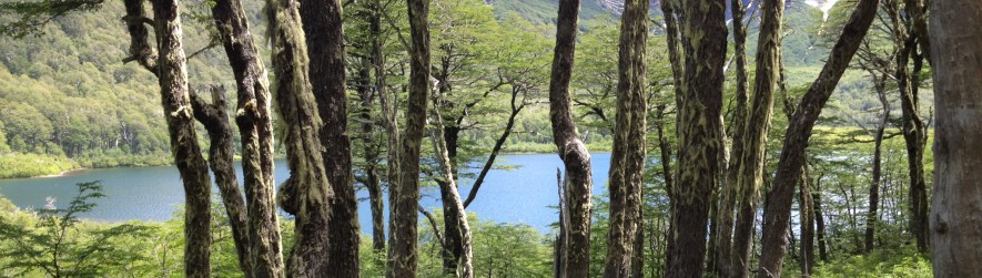
So, I got invited to tag along on a Torres del Paine trip with my good friend Hendrik and his friend Tony to hike the O- Circuit. The O- Circuit, or just “The O” or “The Circuit”, is about 130 … Continue reading
![IMG_20150921_095616[1]](https://andrewscaminos.files.wordpress.com/2015/10/img_20150921_0956161.jpg) After PCT Days we(Tio, Fancy, Pippin, Captain Crunch, Gemstone, Simba, and Navi) drove back to Fancy’s Parents Farm and slept. Simba, Captain, Navi, and Gemstone left the next morning to head back to trail. Tio, Pippin, and I decided to spend a night and enjoy the comforts of indoor living, mainly because it was pouring rain and wasn’t predicted to stop for the next few days. We got back on trail late the next day and had to make it to Stehekin to meet up with Fancy and the rest of our crew.
After PCT Days we(Tio, Fancy, Pippin, Captain Crunch, Gemstone, Simba, and Navi) drove back to Fancy’s Parents Farm and slept. Simba, Captain, Navi, and Gemstone left the next morning to head back to trail. Tio, Pippin, and I decided to spend a night and enjoy the comforts of indoor living, mainly because it was pouring rain and wasn’t predicted to stop for the next few days. We got back on trail late the next day and had to make it to Stehekin to meet up with Fancy and the rest of our crew.
The trek out of Snoqualimie was pretty rough. Lots of elevation change and the weather was unrelenting. We were wet and very cold. The days started with us in our separate tents not wanting to get up till there was a break in the rain. I don’t think we got moving before 11AM once during this leg of the journey.
![1441577783096[1]](https://andrewscaminos.files.wordpress.com/2015/10/14415777830961.jpg)
You know… Sometimes shit just happens.
![1442226543189[1]](https://andrewscaminos.files.wordpress.com/2015/10/14422265431891.jpg)
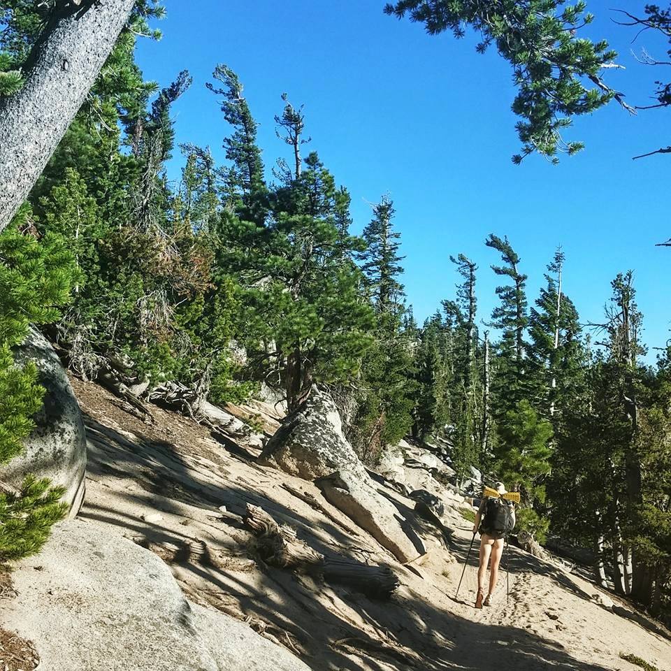
Stevens Pass to Stehekin was an amazingly beautiful section of Trail. The North Cascades didn’t disappoint. It was challenging though, the rugged terrain and poor weather continued. Tio joked that if the Sierras turned us to Marble, Washington turns us into a work of art. I countered If the desert made us marble, and the Sierras made us art, and Oregon made us a master piece then I think Washington is a Wrecking Ball. To some extent this was true. All of us where pretty exhausted upon reaching Stehekin.![1442443996237[1]](https://andrewscaminos.files.wordpress.com/2015/10/14424439962371.jpg)
Stehekin was a cute little town and the weather finally clearing up made it all the more enjoyable. Lake Chalan was an amazing swimming hole and The food while pricey was delicious and lets not forget the bakery. World Famous Stehekin Bakery has some of the most delicious and butter filled pastries you would ever encounter. Due to my ignorance of how lacking on resupply Stehekin was I mainly packed out pastries and pizzas. At first it was delicious and I dropped a lot of weight very quickly. Then it turned into me getting very sick and fatigued as my body tried to metabolize immense starches and fats it wasn’t used to consuming. With 30 miles to go at Harts Pass I considered quitting for the first time. It was that bad. Luckily Legend, a trail angel, was there to take me to town and let me rest at Ravensongs, another trail angel, for the night at which I felt well enough to push forward to the border.![1442325720846[1]](https://andrewscaminos.files.wordpress.com/2015/10/14423257208461.jpg)
![1442435123162[1]](https://andrewscaminos.files.wordpress.com/2015/10/14424351231621.jpg)
The Last Bear
Manning Park Canada was nice. I splurged and split a hotel room with Pippin which included access to a heated indoor pool, two hot tubs a dry sauna, and a steam room. LOVELY. We got a ride back with GG and her husband to Seattle area. I spent the night at Fancy’s farm again and then took a bus to Portland.
After spending half a year of my life on trail I’m currently having some difficulties re adjusting to life after trail. but I’m invigorated by the awareness to this wonderful community of thru hikers and an alternative lifestyle that will always welcome me with open arms. When people tell me I’ve just had a once in a lifetime trip I can’t help but to think, “it’s only ‘once’ if I don’t go on another one.” After this I know I’ll be out there again on a long walk, I can only hope its sooner rather than later.![IMG_20150916_155438[1]](https://andrewscaminos.files.wordpress.com/2015/10/img_20150916_1554381.jpg)

After spending 3 days in Portland I realized a few things. My friends didn’t care in the slightest that I had walked from Mexico to get there, Cities, even small ones like Portland, are almost dibilitatingly overwhelming, and lastly I love trail life.

With that last thought in mind I went back to the trail very reinvigorated. I had a week of slackpacking ahead of me (many thanks to Ms. Fancy Feast) and some amazing friends to do it with.


To celebrate crossing The Bridge of The Gods and entering Washington Simba decided to gather us hiker trash and film a Harlem Shake video. The stoke levels were high and we put out all our enthusiasm into the video. I don’t know how it turned out but I had a great time dancing around on a bridge in Washington in a rain skirt.

Our slack pack began from there. The sun was setting, the forecast was perfect and we had 33 miles to meet back up with our stuff. So we hiked 4 that night with only sleeping bags and food for a day. After that we made 30 more miles to arrive at some trail magic by my dear friend Pinestick.

This trend of trail magic and slackpacking continued. 30 plus mile days starting at noon became the norm. Always ending unceremoniously with a couple beers and passing out before 8:30. It was hard for us. Physically, the milage became overwhelmingly taxing, but the real burden was on Fancy. She spent everyday alone navigating back country roads in a Ford focus with a bunch of smelly hiker gear only to wait at a trail head for us to show up drink beers and promptly fall asleep.
After 5 days of slackpacking and making it to White Pass we called it. Fancy, go home, recuperate, meet us at Snoqualmie and take us to trail days.


Probably the best part of having Fancy there was that she damn near saved our lives. As we we’re going by Mt. Adams the fires near there got worse and worse until we were being rained on by ash and sucking in smoke. We reached a back trail head where a ranger was waiting to kick us off the trail. We had Fancy come rescue us.. And some other hikers. The answer to how many thru-hikers can you fit in a Ford focus with packs would be 8 people 12 packs.
It’s a bummer having had to skip one of the best sections of trail, Goat Rock Wilderness, but it will be nice to have a section to go finish to drag out this amazing experience just a tad bit longer.


Once we made it to Snoqualmie Fancy’s uncle swooped us up and took us to Seattle were Fancy’s parents live on a farm. This became home base for a while. We spent the night and got ready to go to PCT Days the following day.


PCT days was a fantastic yet fairly dreary due to poor weather. It is essentially a festival of gear vendors looking to advertise the latest and greatest along with the tried and tested. They also happen to give out a lot of free swag. In the past few years this event has evolved to have a larger capacity for hikers. As a result hikers use this event as a massive “we are doing it party”. Hundreds of hikers hitch forward and backward to attend and some just push themselves to arrive on foot. All in all I had an incredible time partying with old friends uu celebrating our accomplishments thus far while relishing the adventure to come.


While approching Oregon I was starting to get a little trail worn. I still loved trail life but I was becoming unenthusiastic and maybe even a little appathetic about the life I was leading. I was also faced with a dwindling budget. So I decided I would attempt the Oregon Challenge: to hike the state of Oregon (455 miles of trail) in under two weeks. The challenge involves averaging 32 miles a day including any town stops.

I began the Oregon Challenge headstrong at 1:52 PM on July 27th. It took me 2 and a half days to realize this wasn’t the way to get my head back into thru-hiking. Pushing big mile days is a great thing to do, it’s fun, pushes you to a physical and emotional limit, and is rewarding to say the least. The issues for me comes with doing consecutive big days. Physicaly 30 mile days through Oregon aren’t too demanding but my psyche was very negatively affected because I now HAD to do 30 mile days.


During this time some friends of my from long ago, the Chill Hard Tribe, were catching up. I decided instead of brutalizing my self and tarnishing the amazing experience I would do just the opposite. Meet up with my friends and enjoy Oregon th Chill Hard way.

And chill we did. After a nero into Mazama village near crater lake I met up with Tio, Fancy, and Pippin. Fancy’s parents were there and brought hair dying products. So if course being the hiker trash we are we dyed armpits, beards, and I even dyed a strip of my head hair. We zeroed in Mazama and hung out, and it took us until 4 the following day to finally hike out.

We started the Rim Trail alternate. I trail that parrallels the PCT but follows the Rim of Crater Lake rather than being off in the woods. It was a bummer too see the lake, there were some fires close to the actual PCT and the smoke made such a haze you could barely see the Lake.
While the smoke continued to ruin our view for a couple days past Crater Lake we didn’t mind too much. We moseyed up the trail taking long breaks to play our favorite game, Monopoly Deal. A card version of Monopoly that takes the capitalist cut throat game to a whole new intensity.

We were greeted by wonderful trail magic before the Oregon Skyline Alternate. Nothing coagulates thru-hikes like coolers full of free beer, sodas, and snacks. The best part of this trail magic was the trail angels ability to slack pack is to near by shelter cove, our next stop and resupply on the PCT. This meant we got to wake up and hike/run 22 miles to shelter cove with nothing on our backs except some snacks.
Shelter Cove, treated us well with a gorgeous lake, 10 dollar pizzas, and cheapish beer. We became lethargic and didn’t hike out till late the next day. At this point we were about to separate. Tio and Pippin were going into bend for a few days and I decided to push on to Portland to see some friends from college before pushing through Washington.

It was great traveling solo again. I got to travel at my own pace and just be in nature but, I’m definitely glad to be meeting back up with friends in Cascade Locks to hike Washington.
I also passed mile 2000!


I passed through the beautiful Three Sisters Wilderness. Some of the best views on trail but also some of the hardest terrain due to the Volcanic Rock.


When hiking solo all I could think about was getting to Timberline Lodge in Mt. Hood to eat the breakfast buffet. It is supposedly the best in trail and it did not disappoint. From homemade breakfast sausage to locally produced yogurt and artisinally crafted pastries all for 15 bucks. I definitely got my money’s worth.


Then out of desire to be able to relax and see friends I rushed down to cascade locks. The last 8 miles I met some Nike runners who were going into Portland and offered me a ride so I ran the last bit into Cascade Locks. It was a brutally painful descent but so worth it.

The last few days have been the best vacation from my vacation I could ask for but I’m anxious to be back on trail and living the dream.
A Guest Blog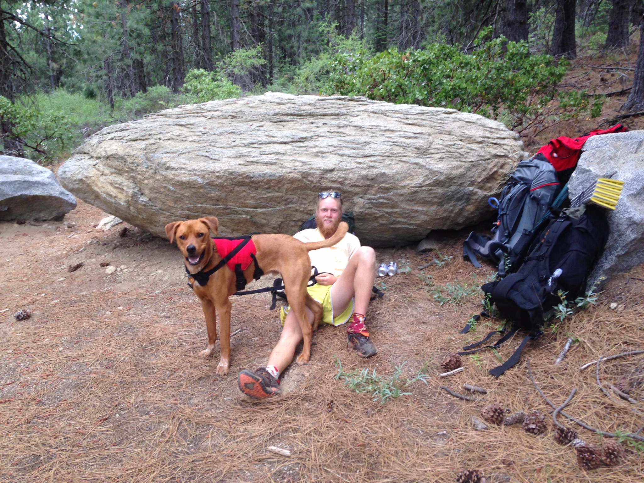
I recently had the chance to join Andrew (trail name: Sunshine) on a short section on his PCT thru hike. As Andrew has had some technical difficulties with posting his blog, I wanted to update those following his trek and hopefully encourage him to find a way to continue his journal.

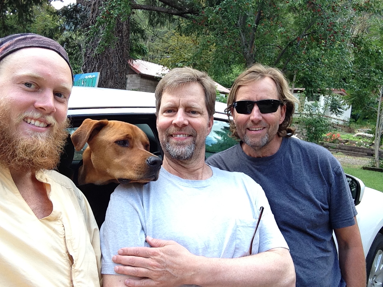
I am Sunshine’s father, Robert. I live in Santiago, Chile. I had to be in San Francisco on business in mid-July, so I took advantage of the trip to meet up with him and see how he is holding up and get a little taste of the trail myself.
First of all, my timing was such that I needed Sunshine to slow down a bit so I wouldn’t have to chase him all the way up past Chester (the halfway point on the trail). So he came up with the idea to spend over a week in Lake Tahoe, hiking the Tahoe Rim Trail.
 Also joining Andrew and me on this piece of the trail was my brother, Scott, and his pup, Rojo. We met up with Sunshine just outside Quincy, CA, a charming town about 1-1/2 hours drive north of Lake Tahoe. First thing was to get him a shower and clothes washed, followed by a steak dinner (a huge treat for someone used to living on trail food with only an occasional hot breakfast from some diner along the trail). After a night in a motel (where Andrew insisted on sleeping on the floor), we finally made our way back to the trailhead. Our actual start was delayed 3 hours as we waited for Scott to shuttle his car to Belden (where he and I would leave Andrew) and hitchhike back. Most of this time was spent huddled against an outhouse in order to stay out of the rain.
 Andrew & Rojo waiting to start the hike
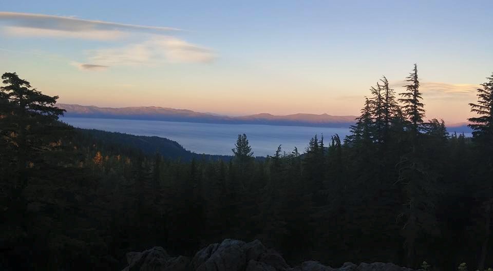
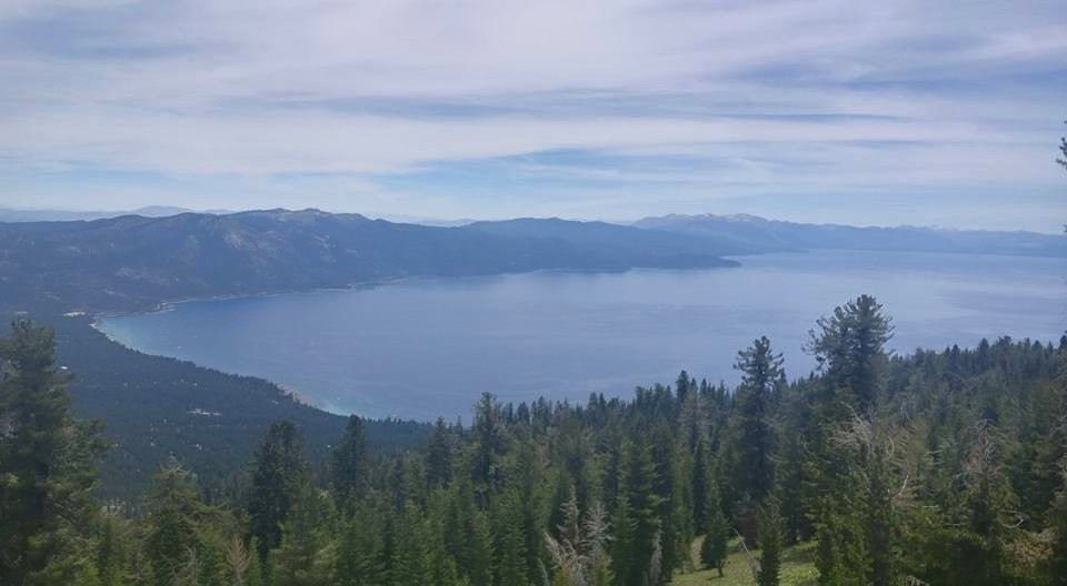
Finally, we were on the trail. And it was fantastic! The trail was very well marked and maintained, the views and smells of the Northern Sierras were awesome, and perhaps best of all, I had three days ahead of me with my son and NO cell phone or internet connection.
THE TRAIL
One of the things that immediately caught my attention were the vast number of wild flowers blooming in the meadows: reds and blues, purples and yellows, whites, pinks and oranges. I stopped counting after 20 different ones, then found at least another 6 varieties on the other side of the summit. This was July during a horrible drought, but on the eastern slope of the Sierras, with the monsoons swirling around the deserts to the east, we had rain and moisture.
The other parts of the trail were mostly under a canopy of old growth lodgepole and Jeffery pine and red fir, or exposed sections of California scrub brush yielding magnificent views of granite rock faces and mountain lakes.
 Granite outcropping
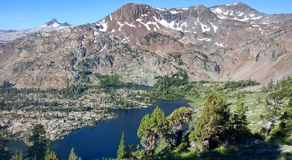
 Silver Lake
As the trail was fairly well travelled with both people and dogs, wildlife was not abundant, although we did see a number of deer, including a handsome young buck that appeared just in front of me on the trail and seemed to be as curious about me as I was with him.
THE THRU-HIKERS
I must say that Sunshine has certainly found his ‘tribe’ within the hiker community. Most hikers we encountered had huge smiles and simply seemed to be having the time of their life. Whether they had met each other previously or not, they were all willing to share stories, news, supplies and laughs.
We had the privilege of sharing our campsite with Wally and Snowflake one evening. The conversation tended to be extremely focused on the PCT, both about the adventures on the trail and about details only a thru-hiker might appreciate (calories/gram of food items, when to eat proteins vs. sugars, the features and attributes of the gear that everyone had to carry, the pluses and minuses of the footwear brands, how much water to carry on any given section, etc.). These guys knew their stuff!
The thru-hikers, as far as I could tell, fell into two main groups. The much larger group were mostly twenty-somethings that were having this adventure early in their careers before being burdened with job promotions, kids and mortgages. These guys wore their Grizzly Adams’ beards and unshaved bodies like badges of honors, sporting weird tan lines and months of ground in dirt that one might expect to see on Skid Row.
At the other extreme were a few grey-haired guys that had already left their careers behind them. This group was more groomed and scrubbed, hiking at a slower, more deliberate pace, stopping often to take in the scenery and communing with nature.
Anyone that I met that did not fall into one of these two groups turned out to be ‘section’ hikers, enjoying a long weekend or getaway vacation, much like Scott and me.
THE FOOD
Sunshine, through his first 1200 miles or so, had stripped down his pack to the absolute bare essentials. He had also decided along the way to get rid of his camp stove in favor of carrying fresh food (which weighs more than those freeze dried packets of food available in backpacking stores). But since Scott and I were only on the trail for three days, and had a stove, we managed to eat quite well, thank you, combining the best of both approaches. We even had freshly fire-roasted red pepper as part of one of our meals. I think Snowflake and Wally were a bit envious of our ‘family’ meal!
THE PAIN
Thru-Hikers, young and old, are lean-muscled, trail-calloused backpacking machines! Not so much for us middle-aged desk jockeys. While I was quite proud that I was able to hike over 15 miles on our last day on trail, I was in no way prepared for the several miles of downhill switchbacks that led us into Belden. Even the backpacking machines were complaining of being a little sore. I could barely stand up! My calves were baseball knots and my feet throbbing masses. This gave me an even higher sense of awe and amazement for the hundreds of thru-hikers that start and complete this endeavor in just a few short months.
SUNSHINE’S STATUS
After leaving us in Belden, Andrew reached Chester a couple days later, then continued on through the long and isolated Northern California trail.
As I write this, Andrew has crossed from California and is now in Oregon. He has now hiked over 2000 miles with only about another ~500 to go.
He has promised to get back to posting on his blog once he reaches Portland, where he will have better access to the technology to do so. He is looking forward to meeting up with some of his Lewis & Clark friends to share stories of his adventures, before completing the final leg through Washington State and into Canada.

TAHOE RIM TRAIL
Robert and Andrew made plans to meet up on Robert’s upcoming trip to the United States, however, to make that happen Andrew needed to slow down a bit.
Rather than stop altogether he decided to take a side trip and hike the Tahoe Rim Trail. These photos are from that week-long hike…
(Stay posted for Robert’s guest blog coming soon!)


My first bear!


These weren’t even 24 hours old! Tripped on a stick…
Happy Hike Naked Day/Summer Solstice (glad I didn’t run into any other hikers!)


Woot woot, finished the TRT
Below is a post Andrew wrote but it never uploaded to the site…those technical issues!
Hopefully I have the images in a similar order to what he intended…all errors are mine.

The trip from Reds Meadow to Tuolumne Meadows was a quick one. Only a day and a half and it was a great one.

Devils Postpile is one of the best example of basalt column in the world!
Gotta’ stop and climb a little.


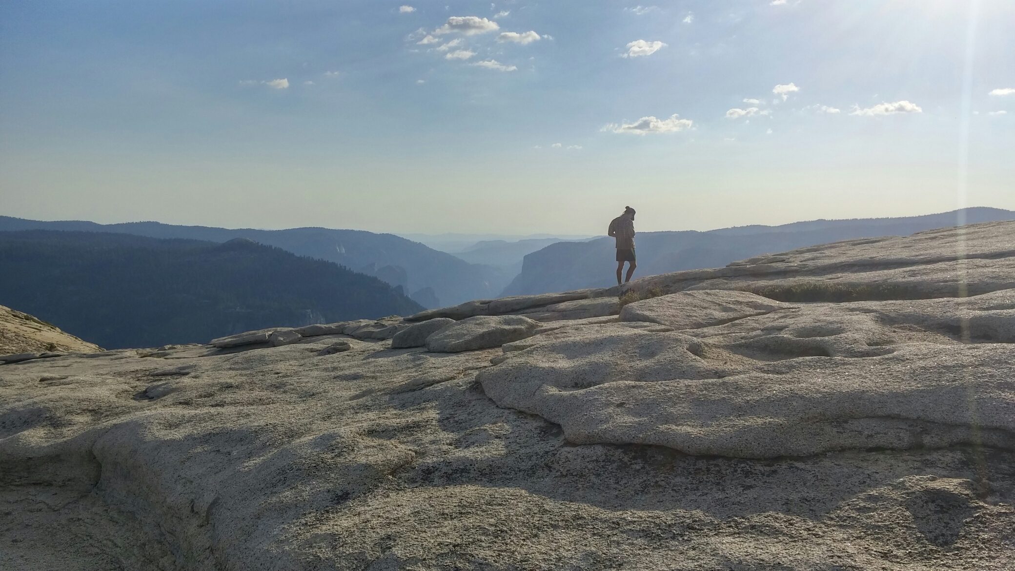
In Tuolumne, Legolas (Peter) and I decided to finish the John Muir Trail (JMT) and overlook the valley. We hiked up Half Dome, got eaten by mosquitos, but realized the Valley is actually Disneyland in disguise.

We slept at Little Yosemite and spent the next day exploring the valley. We went to Camp 4 and slacklined at it’s birthplace, saw El Capitan and had fun in the village.
We bussed back to Tuolumne and continued north. While we got rained on the first day (which sucked), the sun was out in the morning which allowed us to dry everything.

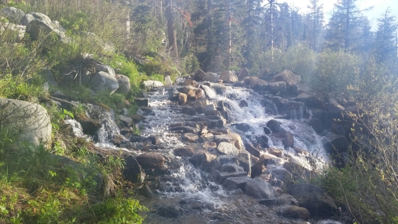 However, just because the rain stopped didn’t mean we stayed dry. We had rivers to ford, marshes to wade, and streams to cross… sometimes the trail WAS a stream.
But that wasn’t bad. What was dreadful were the mosquitos. No safe place from mosquitos. The last night we pushed out an extra 12 miles to make it a 34.7 mile day just to not deal with skeeters. It was beautiful and the best decision of the trip.
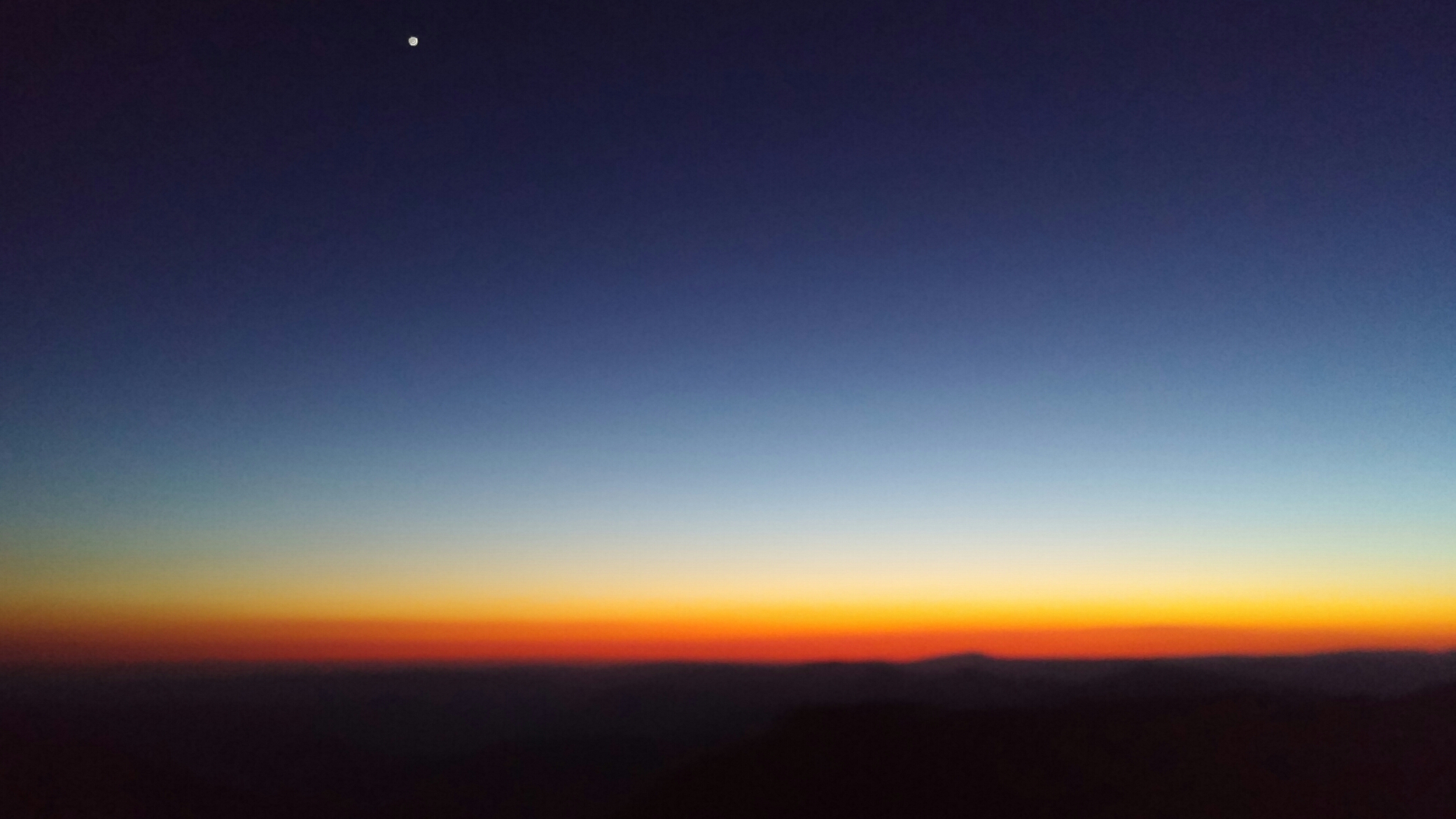
The sunset lasted for hours getting deeper shades of red and orange. Also Venus watched over us, seen at the very top of this photo.

Oh, I also crossed mile 1000!

Peter shortly into the trip with some lovely snow shines
Over the last few weeks my phone has been broken and I haven’t been able to blog.
A lot has happened. I’ve traveled from mile 444 last post to now mile 906. I exited the desert and have been traveling in the crown jewel of the PCT, the High Sierras. My friend Peter, trail name Legolas, joined me at Walker Pass and will be leaving me at Sonora Pass. (Check out some of his posts at Mountainlessons.com he writes a lot about running and ski mountaineering. Also look for some posts and beautiful photos from his time on the PCT coming soon)
All in all life has been wonderful and I hope to keep blogging more in the future.

One of many panoramic views

Puesco is the SE Terminus and El Centro de Ski is the NW.
My time in Pucón was coming to an end but not without a last hoorah. I had been planning a 3 day trek called the Villarica Traverse. A 50 mile trek with terrain ranging from lush forests to marshland to rocky and snowy alpine. The trek is traditionally done from El Centro de Ski to Puesco. I did it reverse as it was recommended to me and because I thought it would be easier to hitch back to Pucón from the ski lodge.

Bye Parents!
Day 1: My parents planned to take me to Puesco and hike with me for a little bit before saying goodbye until I was back in Santiago. Shortly after leaving them the climb really started to pick up. Totally worth it as the views were just stunning. I stopped to eat lunch around 2:30 and made myself some PB Tortillas… probably the biggest staple of my diet back or front country. I then spent a good half hour swatting mosquitos and horse flies while trying to enjoy my tortilla.

The first bit o’ snow.. definitely not the last
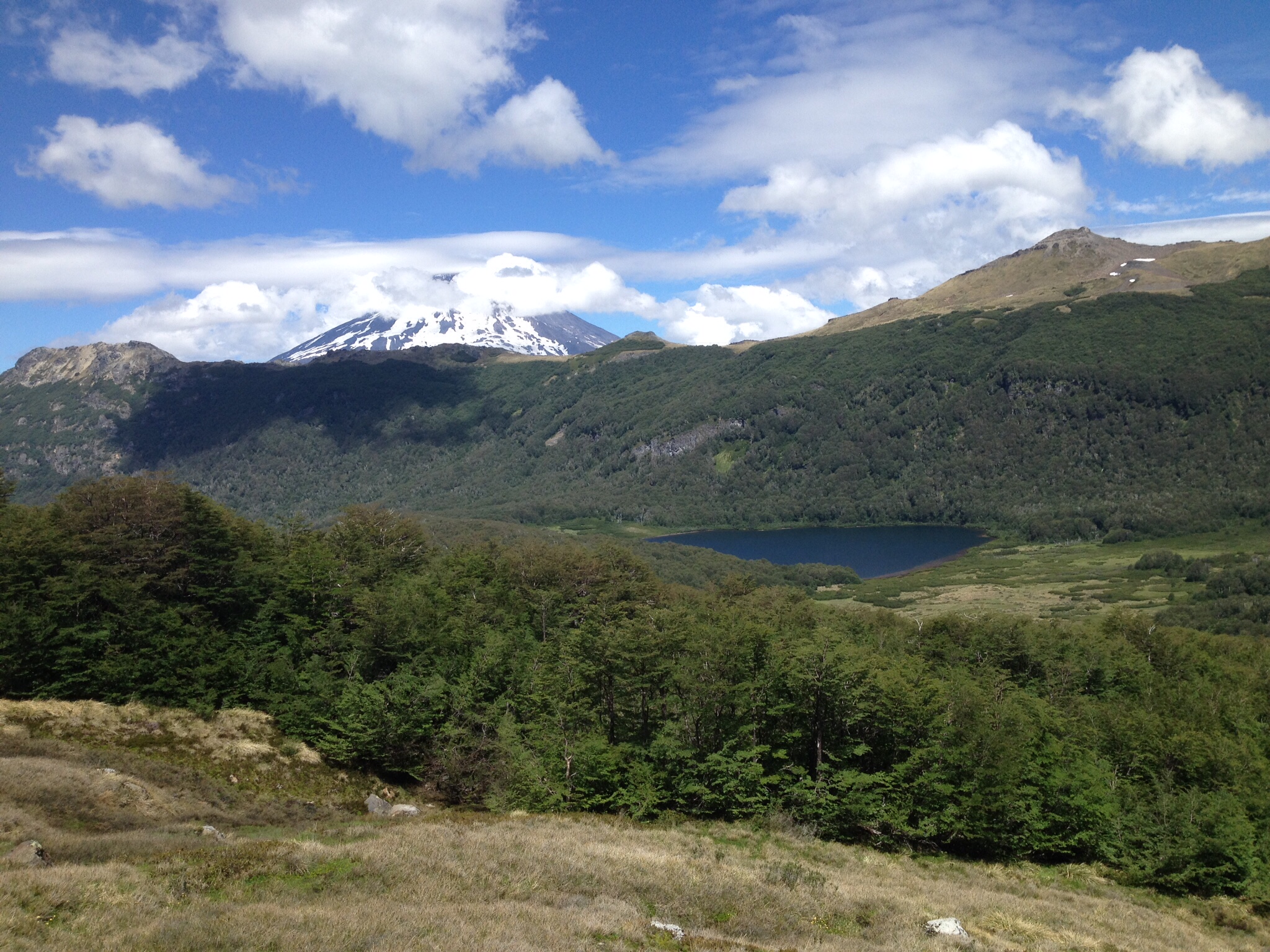
Won’t be in trees for awhile. Volcán Lanin in the background there with Lago Avurtadas

Yummy couscous dinner
The hike from lunch till dinner was filled with beautiful scenery but otherwise uneventful other than the fact that I broke tree-line and crossed my first patch of snow for the trip. Right after dinner was the biggest river crossing of the trip, which kinda sucked because it was glacial run off and it was starting to get dark. It was really friggen’ cold. Got to camp around 8PM. Lago Azul was beautiful, unfortunately I forgot to take a picture that night and by morning fog had rolled in and you couldn’t see it. Met some Chileans that night trying to climb Volcán Calafquen the next morning, they invited me to come along. I agreed. It rained that night.
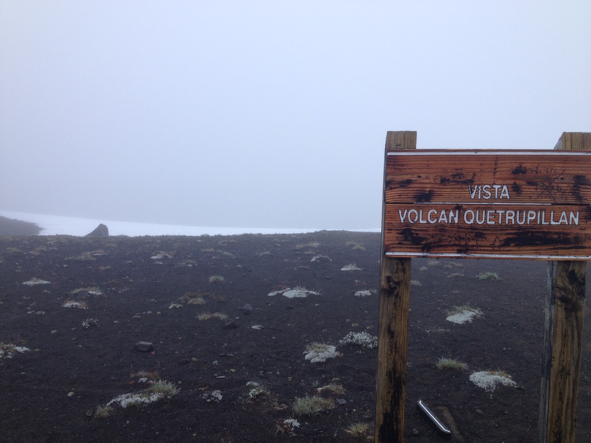
Vista Volcán Quetrupillan. But wheres the volcano? Views for the entirety of day 2
Day 2: woke up early and it was still raining and completely socked in. Asked the Chileans if they were still up for climbing the volcano, they said no so I took off to continue my trek. It was raining that entire morning so I was super excited to be back in tree line after doing some serious snow passes. I was excited that is until I realized the trail was overgrown and the plants got me more wet than the rain did. Shortly thereafter I took a wrong turn and ended up way off trail. I re-oriented my self and decided instead of turning back I would try doing a short road walk that would hook me up with my trail at a ranger station.
The road walk turned out to be quite long and very confusing. I eventually did get back on trail right around noon and decided to forge forward. Then came the steepest climb of the trail and the first time I felt like I needed to stop and catch my breath. It eventually switched to a more gradual incline and I broke tree-line again to find powerful winds and a short walk up to the mirador de volcáns.. you couldn’t see a single volcano because of the fog. I realized the trail stopped going forward as far as I could tell. I assumed it was just because of the nature of the terrain. My intuition told me I’d reconnect with the trail just around the next mountain.. I was wrong.
I ended up getting rather lost. Hiking up and down serval valleys and remaining off trail for several hours. I started getting fairly nervous and was trying to reorient myself every 10 minutes or so, thinking every path made by a falling rock was my trail. I decided that I would hike towards tree-line and walk along side it till the trail reconnected or until I crossed path with the trail as I was fairly certain I was uphill from the trail. Luckily this worked out and I made it back on trail a little bit further back than I thought I was. It was only a short walk from there to the campsite.

After getting lost…

After finding trail again…
That night was going fine and dandy until I was making dinner and I hear something scream a the top of its lungs. It scared the living shit out of me. After two more screams and it getting closer I realized it was a cow who most likely lost it’s mother. It charged past my campsite so I went back to cooking. Right when my quinoa was done I hear the same scream but really close. I peeked out from my vestibule to see the cow’s face only feet from mine. Instinct told me cows would respond well to aggressive tactics. So I got up made myself as big as possible and chased it off. It gave me no more problems after that.

To the left is Lago Calfaquen and to the right is Lago Villarica. Amazing!

Ouch!! Nothing a needle and ductape won’t fix.
Day 3: The next morning I woke up to some pretty bad toe pain and realized I had a blister that I didn’t notice the night before. Gnarly as it was a needle and duct tape solved that problem real quick. I had a short walk to the Centro de Ski that morning only about 12 km took me 3 hours. Some great views as the fog finally settled. Due to the bad weather over the past few days the normal tours up the volcano starting from the ski resort were canceled(meaning no traffic and no rides), luckily an Argentine and his son whose trip was canceled decided to come up to play in the snow anyways and offered me a ride into town.

Is that what’s considered a ski resort down here.. why yes, yes it is.
Spent the next 8 hours chilling in Pucón at different gear shops and coffee bars waiting for my bus that night to Santiago.. they give you a lot more leg room in busses than they do on planes.
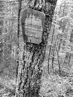 Over Thanksgiving weekend and my buddy George and I attempted to thru hike the Mark O’ Hatfield Memorial Trail (MOH). MOH is a 60 mile trail that goes through the Columbia River Gorge National Scenic Area or more specifically the Mark O’ Hatfield Wilderness very close to Portland, Oregon. It starts at the famous Multnomah Falls Trail Head and ends at the Starvation Trail Head. It traverses some of the most beautiful outlooks of the Willamette River as well as some of the best terrain the Columbia River Gorge has to offer. The trail as of right now is still under construction, the idea is to expand the trail into nearby Bull Run Watershed the issue is it is protected by The City of Portland. It is still far from completion.
George and I started out the trip Wednesday Afternoon, after we finished our last classes of the day, driving out to Starvation Trail Head and hitched back to Multnomah Falls Trail Head. We then at 3:30PM began what was supposed to be a 4.5 day journey.

George Left, Me Right. Multnomah Falls in the background.
After hiking 5.2 miles most of which was in the dark because it gets dark around 4:30 this time of year we decided to stop and make camp near Larch Mountain. It rained a bit that night and a lot of pinecones fell on my tent. We woke up eager to get moving and decided to hold out on breakfast till the next water source. Shortly after starting it began to rain and didn’t stop… ever. We hike about 16 miles Thanksgiving day. Giving up and making camp just off trail in a last ditch attempt to be out of the rain. We (I really mean I) were too cold and wet to get out of the tent long enough to make dinner, which were supposed to be some lovely thanksgiving tv dinners. Instead we miserably stayed in the tent and ate bagels, tortillas, summer sauce, and BANANA CHIPS. We decided that if it wasn’t sunny and beautiful the next day that we were through. We would hike out to the road and hitch it back to our car.
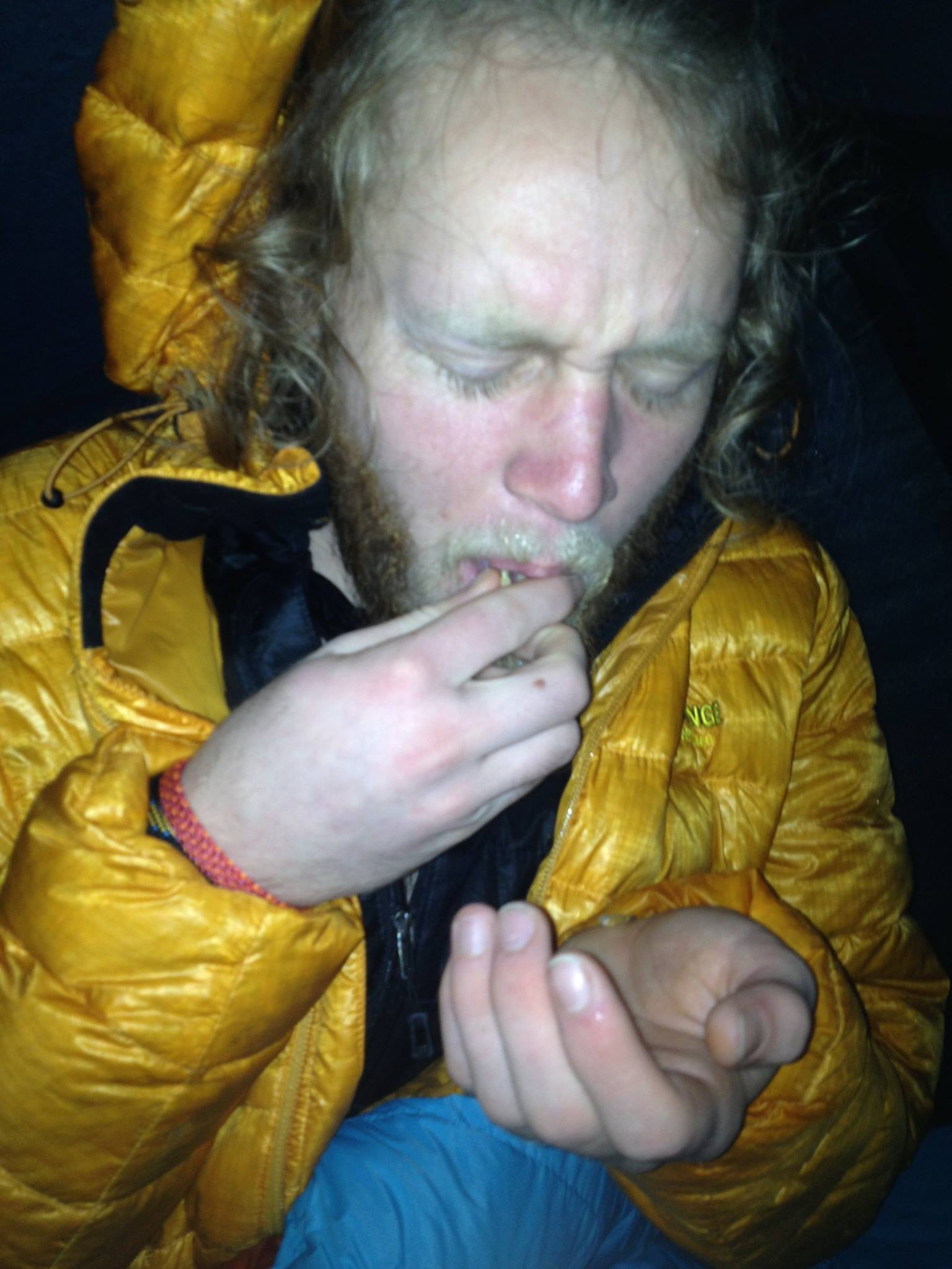
This picture just about sums up how miserable we were.

OH NO, HORNETS!
Our 3rd and last day we struggled getting out of our tent as it was still pouring outside and my pants were still fairly wet from the day before. Once we got going we found ourselves to be wading through a trail turned creek. We still managed to enjoy ourselves and even laugh at a sign saying, “HORNETS AHEAD” obviously left by someone who had hiked the trail during the main hiking season as no hornets nest would still be dangerous in this rainy weather. We continued and had the scariest adventure yet. We came upon Tanner Creek, what is normally a not-quite-so-knee-high creek crossing had turned into a more-than-waist-deep river crossing.
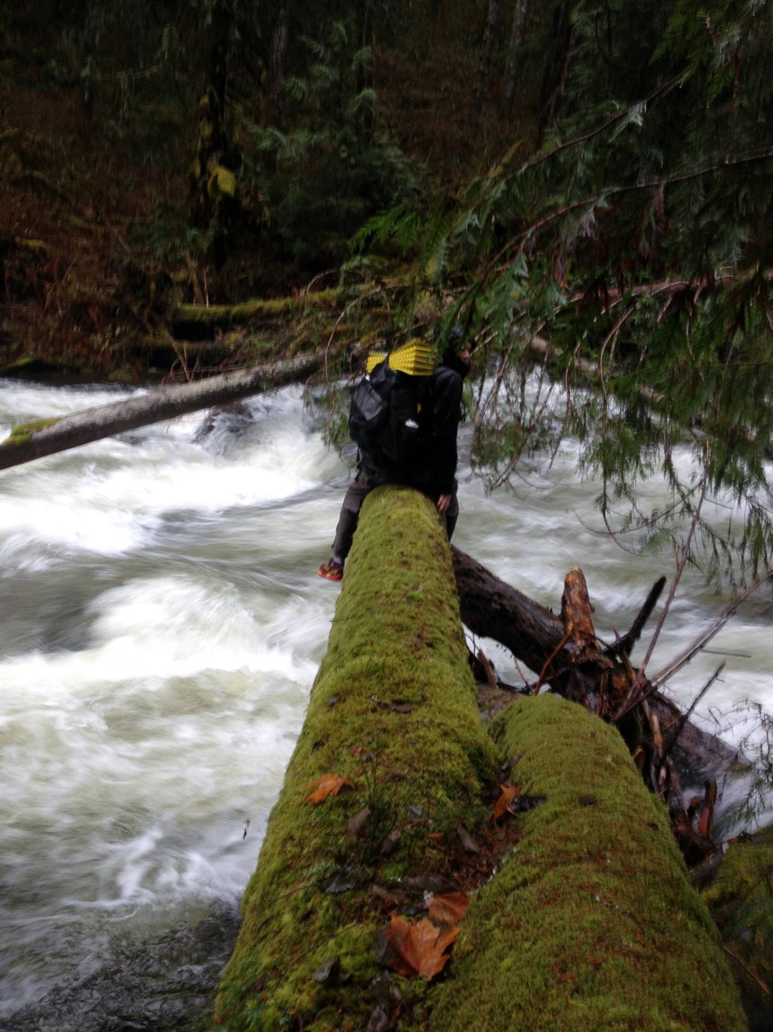
Tanner Creek Crossing
We had a decision, turn back and spend another night out or figure out a way to cross. We saw some downed tress about 500 ft down river which looked like they went all the way across. We fought our way through brush over to them and did some quick risk/reward scenarios. We went for it. Luckily we both made it across with no problems. We continued out and took a fire road back to the Columbia River Gorge Scenic Highway and hitched back to our car. We then went to Burgerville, the best fast food chain of the Northwest in my humble opinion.

Map of the trail
